Dual Link Image Coding for Earth Observation Satellites


|
Dual Link Image Coding for Earth Observation Satellites |

|
|
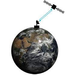
In general, image coding schemes are devised so that the device that captures the image also codes and transmits it to the receiver via a communication link. Despite that most communication links are nowadays full duplex (i.e., data transmission can occur in both directions simultaneously), image coding schemes solely employ one of the two communications links, leaving the other idle during the whole transmission time. If the acquired image is completely unknown to the receiver, this is the only possibility. However, if the receiver has some prior knowledge of the acquired data, it may use the idle link to send an estimate to the acquiring device. The acquiring device can remove the redundancy between the estimate and the captured image, coding only those data that differ from the estimate. Such coding and transmission scheme employs both links of communication. This research introduces this idea and proposes a dual link image coding scheme for the transmission of images captured by Earth Observation satellites. Such satellites acquire huge amounts of data that have to be transmitted in short intervals of time, often resulting in data losses. The proposed scheme increases the coding performance of such coding systems, allowing the transmission of more (and of higher quality) images. |
| DUAL LINK IMAGE CODING FOR EARTH OBSERVATION SATELLITES |
|
ABSTRACT: The conventional strategy to download images captured by satellites is to compress the data on board and then transmit them via the downlink. It often happens that the capacity of the downlink is too small to accommodate all the acquired data, so the images are trimmed and/or transmitted through lossy regimes. This paper introduces a coding system that increases the amount and quality of the downloaded imaging data. The main insight of this work is to use both the uplink and the downlink to code the images. The uplink is employed to send reference information to the satellite so that the on-board coding system can achieve higher efficiency. This reference information is computed on the ground, possibly employing extensive data and computational resources. The proposed system is called dual link image coding. As it is devised in this work, it is suitable for Earth observation satellites with polar orbits. Experimental results obtained for datasets acquired by the Landsat 8 satellite indicate significant coding gains with respect to conventional methods. |
| PAPER: F. Auli-Llinas, M.W. Marcellin, V. Sanchez, J. Bartrina-Rapesta, and M. Hernandez-Cabronero, Dual link image coding for earth observation satellites, IEEE Trans. Geosci. Remote Sens., vol. 56, no. 9, pp. 5083-5096, Sep. 2018. (DOI:10.1109/TGRS.2018.2806082, doc.pdf1.2M) |
|
PRESENTATION: slides.pptx25M |
| DUAL LINK IMAGE CODING BASED ON CCSDS-123 |
|
ABSTRACT: Predictive coding techniques are attractive for image codecs because they can yield high compression efficiency while spending few computational resources. In remote sensing, predictive techniques are employed in prominent standards to transmit images captured by Earth Observation (EO) satellites. Although EO satellites have full duplex capacity, compression standards for spatial data are devised to use the downlink only. Recently, we presented a dual link image coding system that employs both the uplink and the downlink to accelerate the transmission of such images. The proposed system was introduced in the wavelet-based JPEG2000 standard, which is not well-suited for satellites due to its complexity. This paper approaches the dual link scheme to a more suitable standard for spatial data based on predictive coding, more precisely, the Lossless Multispectral and Hyperspectral image compression standard CCSDS-123.0-B.2. The proposed method adapts the dual link image coding scheme to CCSDS-123.0-B-2 by incorporating a quantizer, a lightweight arithmetic coder, and a rate control technique. Experimental results suggest that the resulting system achieves higher coding ratios than CCSDS-123.0-B-2 and JPEG2000 with dual link. |
| PAPER: J. Bartrina-Rapesta and F. Auli-Llinas, Dual link image coding based on CCSDS-123, IEEE Geosci. Remote Sens. Lett., vol. 19, pp. 1-5, Jan. 2022. (DOI:10.1109/LGRS.2021.3062903, doc.pdf614K) |